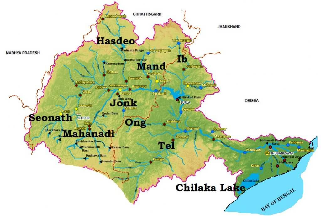
#35 Mahanadi River system
The Mahanadi basin extends over states of Chhattisgarh and Odisha and comparatively smaller portions of Jharkhand, Maharashtra, and Madhya Pradesh, draining an area of 1.4 lakh Sq.km.
It is bounded by the Central India hills on the north, by the Eastern Ghats on the south and east, and by the Maikala range on the west.
The Mahanadi (“Great River”) follows a total course of 560 miles (900 km).
It has its source in the northern foothills of Dandakaranya in Raipur District of Chhattisgarh at an elevation of 442 m.
The Mahanadi is one of the major rivers of the peninsular rivers, in water potential and flood producing capacity, it ranks second to the Godavari.
Other small streams between the Mahanadi and the Rushikulya draining directly into the Chilka Lake also forms the part of the basin.
The major part of the basin is covered with agricultural land accounting to 54.27% of the total area.
It is one of the most-active silt-depositing streams in the Indian subcontinent.
After receiving the Seonath River, it turns east and enters Odisha state.
At Sambalpur, the Hirakud Dam (one of the largest dams in India) on the river has formed a man-made lake 35 miles (55 km) long.
It enters the Odisha plains near Cuttack and enters the Bay of Bengal at False Point by several channels.
Puri, at one of its mouths, is a famous pilgrimage site.
Tributaries of Mahanadi River
Its upper course lies in the saucer-shaped basin called the ‘Chhattisgarh Plain’.
This basin is surrounded by hills on the north, west, and south as a result of which a large number of tributaries join the main river from these sides.
Left bank Tributaries: The Seonath, the Hasdeo, the Mand, and the Ib.
Right bank Tributaries: The Ong, the Tel, and the Jonk.


